
The yellow lines lead into brown water, then disappear. At Tortilla Flat near Canyon Lake, a stretch of road was covered by flowing water on Sunday, November 1, 2026.
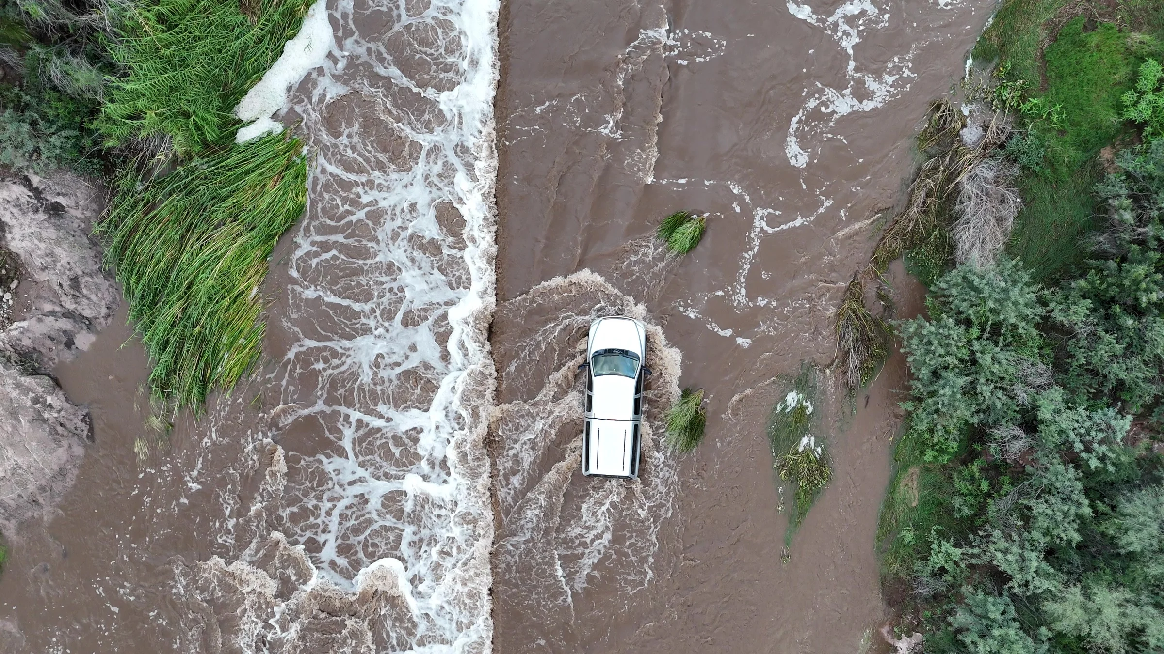
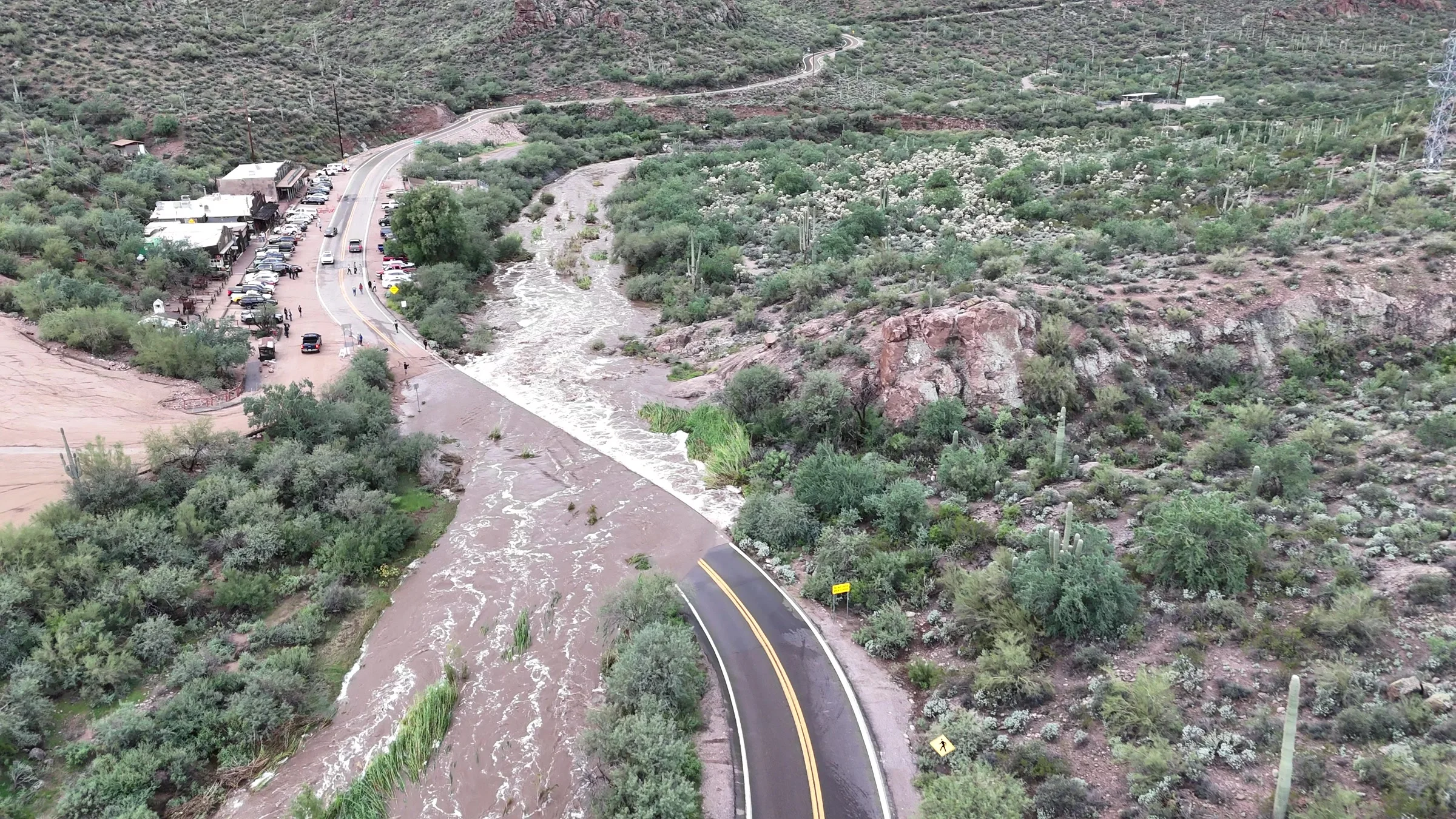
Drone and ground-level video recorded by East Valley Explorer’s Zac Coplan shows the same crossing from two perspectives: a sheet of water over the pavement at road level, and a white pickup moving through the flooded stretch from above. The images below are actual frames from that footage.
Video and still images: Zac Coplan / East Valley Explorer. Recorded November 1, 2026.
Where the pavement disappears
One aerial view makes the road’s path especially clear. The curve and its double yellow centerlines are visible in the foreground before meeting the brown water. Beyond the flooded section, the roadway continues toward Tortilla Flat’s buildings and parked vehicles.
A long band of white foam marks the edge beside the covered pavement. Vegetation remains visible in the water, while the road markings vanish from view across the flooded section.
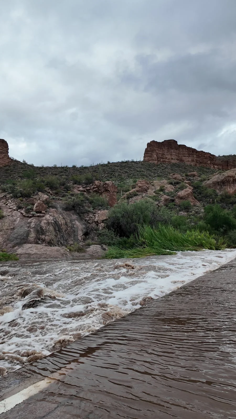
From the ground, the scene looks different. Ripples run across the water covering the pavement, and foamy water spills over the road’s edge beneath the desert cliffs. This closer view shows the transition from the submerged surface to the churning water alongside it.
A pickup moves through the flooded stretch
The drone footage also follows a white pickup moving through water over the roadway. Water parts around the front of the truck and trails behind it as it continues toward the visible asphalt and centerlines at the other end.
Later in the same recording, the pickup reaches exposed pavement. That sequence documents one vehicle’s movement through the crossing; it does not establish the water’s depth or that the road was safe to use.
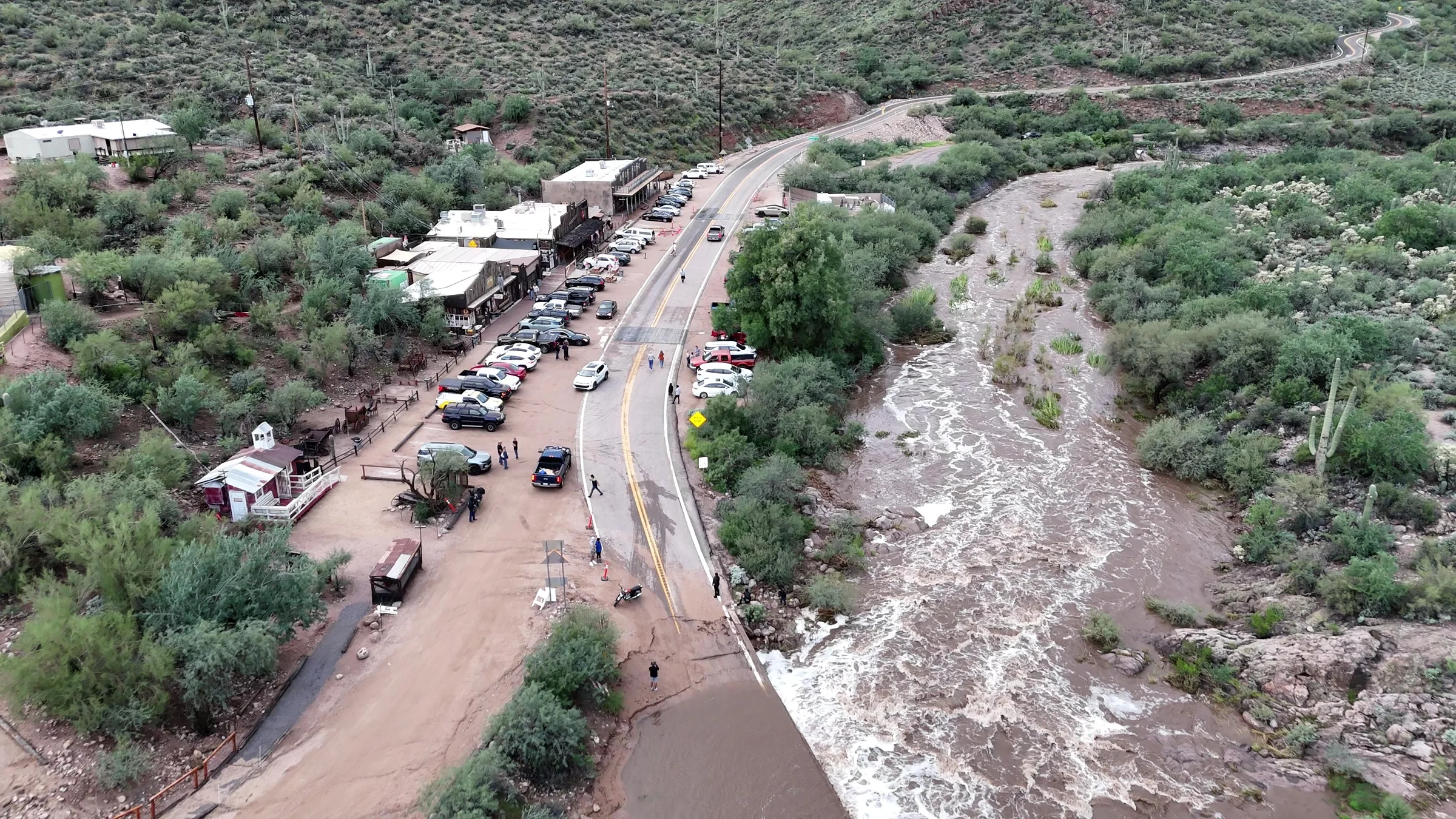
The wider aerial view puts the crossing in its surroundings. Buildings and parked vehicles line one side of the road, with people visible near the roadside and flowing brown water beside the paved route.
The weather warning that evening
In a warning issued at 6:04 p.m. MST on Sunday, November 1, the National Weather Service in Phoenix included Tortilla Flat and Canyon Lake among the affected locations. The agency reported elevated creek flows following earlier rainfall and said flooded low-water crossings could be impassable. That warning was scheduled through 8:15 p.m. that evening.
The warning covered a broader area. The photographs here document the road crossing at Tortilla Flat and do not establish a lake-level change.
Our separate October report explains Canyon Lake’s planned drawdown for dam inspections and maintenance. That coverage concerns the reservoir project; the images here document roadway flooding at Tortilla Flat.
Check current conditions before a drive
These images record conditions on November 1, rather than the road’s status when you read this. For current highway restrictions and closures, check AZ511 before heading out. East Valley Explorer has not verified a specific closure for this crossing.
The National Weather Service’s flood guidance advises against driving or walking into floodwater. A vehicle reaching the other side is not a reliable test of the road beneath the water.
