
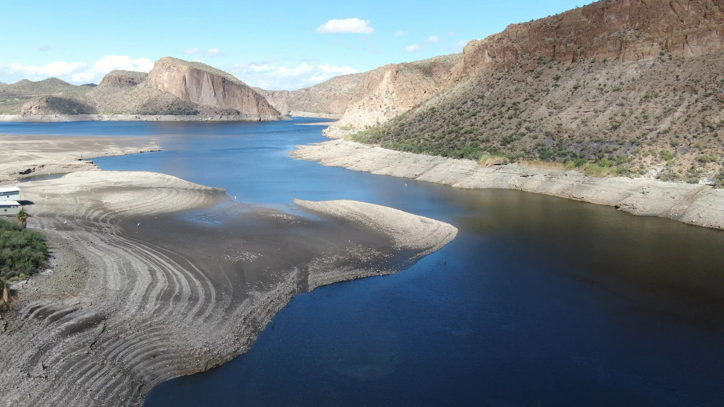
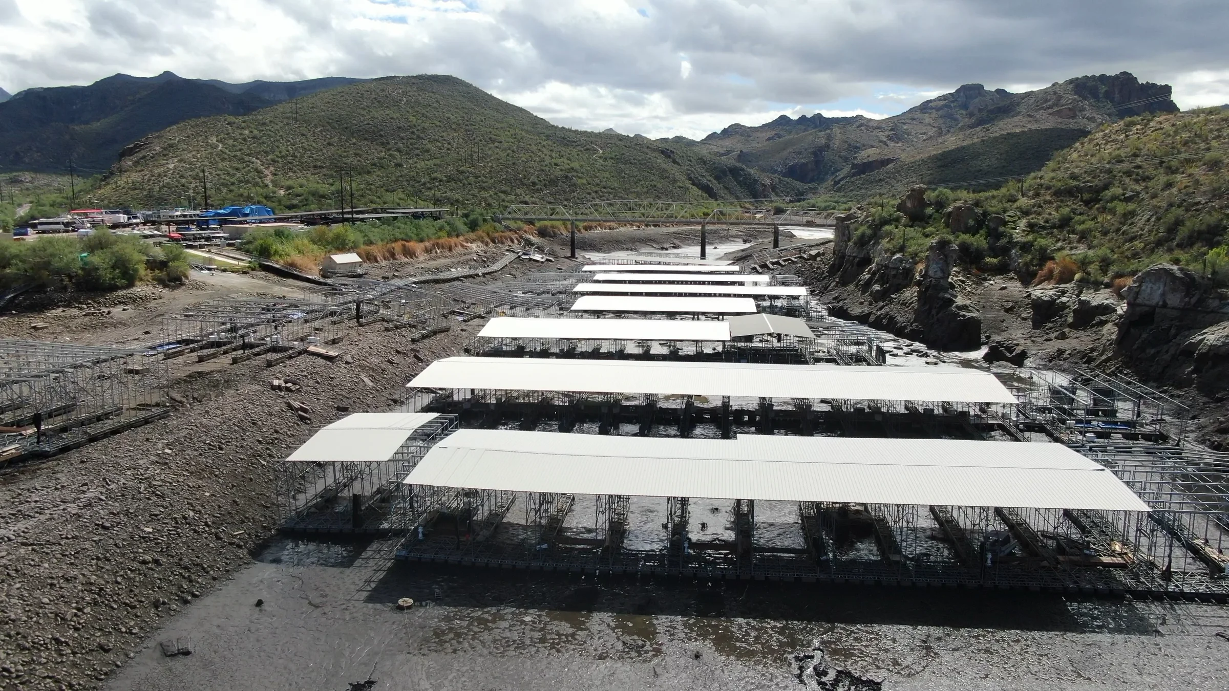
Canyon Lake still has its blue water and towering desert walls. But in footage captured October 11, the space between them looks startlingly different: broad gray shelves curl into the lake, pale bands trace the shoreline, and exposed ground surrounds rows of marina structures.
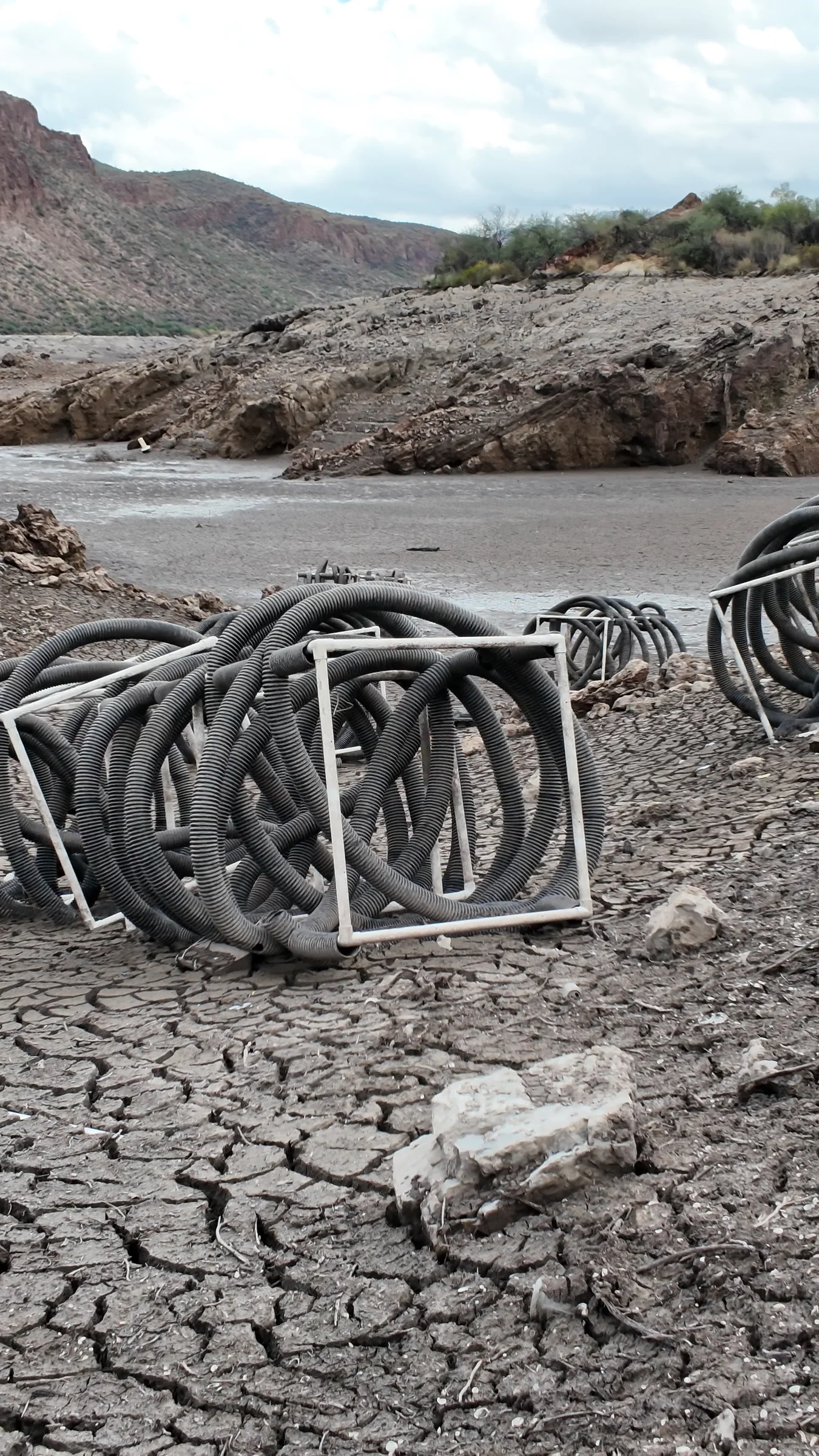
Then the camera gets closer to something stranger. Dark, ribbed coils loop through pale rectangular frames on cracked ground. Against that newly visible landscape, they practically supply their own caption: What are these?
That question remains open. The larger question behind the footage has a clear answer: Canyon Lake is being deliberately lowered for a major dam inspection and maintenance project. The dramatic shoreline is part of a planned operation, and the exposed lakebed is closed to public exploration.
First, about those coils
The footage shows several groups of dark coils arranged within light-colored frames. You can see their repeating loops, ridged surfaces and the cracked ground around them. What the images cannot tell us is who put them there, how long they have been there or what job they were meant to do.
East Valley Explorer has not verified their identity. Giving them a confident label would turn an intriguing photograph into an unsupported claim. For now, the detail worth noticing is how much a receding shoreline changes what catches the eye. A wide view invites you to follow the water; a close view makes you stop at an object you cannot immediately explain.
Why lower the lake by about 54 feet?
According to SRP's September 8 project announcement, SRP and the U.S. Bureau of Reclamation plan to lower Canyon Lake roughly 54 feet. Crews need access to normally submerged parts of Mormon Flat and Horse Mesa dams, plus the river channel below Horse Mesa.
There is a useful distinction here: 54 feet is the planned lowering, not a measurement established by these photographs. The October 11 footage shows substantial exposed shoreline and plenty of remaining water. It does not establish that the final target has been reached.
SRP's project overview identifies comparable major drawdowns in 2007 and 1987. Routine maintenance happens between those events; this is the roughly 20-year work that requires lowering the water for access. Calling it the first safety inspection in two decades would miss that distinction.
The setting can make the engineering easy to overlook. Mormon Flat Dam forms Canyon Lake, and SRP dates its construction to 1923-1926. The dam has two hydroelectric generating units. Those cliffs and coves frame a working reservoir with a century of infrastructure behind it.
Where does all that water go?
SRP says water released during the drawdown passes through Saguaro Lake and into the lower Salt River to meet the Valley's water needs. Refill water will come from Apache and Roosevelt lakes upstream. Its drawdown FAQ explains that sequence; its September announcement says normal customer deliveries will continue.
That is the everyday connection behind the unusual scenery. The water leaving this view still has a destination in the Valley's supply system. For another look at the infrastructure behind daily water use, our Signal Butte Water Treatment Plant explainer follows a separate part of Mesa's system: treatment of Colorado River water delivered through the Central Arizona Project.
How long will Canyon Lake look like this?
SRP's announced schedule is approximately 16 weeks beginning September 16, 2026: about four weeks lowering the lake, eight weeks inspecting and maintaining the equipment, and four weeks refilling it. These are estimated phases, not fixed reopening dates.
SRP says fall timing keeps hydropower available through peak summer demand and aims to finish ahead of late-winter flood risks. Additional repairs discovered during the work could extend the schedule, according to its project FAQ.
The access calendar is separate. Forest Order 03-12-00-26-22 runs from September 8, 2026, through February 28, 2027, unless rescinded. The 16-week estimate should not be read as a guaranteed January reopening. Check the official project page and Forest Service alert for changes before making lake plans.
Can you go see the exposed lakebed?
The lakebed is closed. The Forest Service order covers the marina and recreation sites including Acacia, Palo Verde, Boulder, Laguna and Tortilla Campground. It cites unstable exposed shoreline and unsafe lakebed conditions. SRP also warns of deep mud and sudden drop-offs.
The order lists SR 88 and Boulder Canyon Trail 103 outside this closure. That does not establish current road or trail conditions, and it does not authorize entering the closed lakebed from either one. Check ADOT's Apache Trail information and current Forest Service notices separately.
For now, the footage offers a way to study the transformation without treating the exposed ground as a new recreation area. Look at the curved shelves, the distance between the marina structures and the water, and the contrast between a broad blue channel and a tangle of unexplained coils.
The coils leave us with a small mystery. The wide view tells the bigger story: a familiar East Valley lake temporarily revealing more of its edges while crews prepare to work on the infrastructure that holds and moves its water.
Reporting checked October 11, 2026, Arizona time. Images are unoverlaid stills from original footage recorded that day by Zac Coplan / East Valley Explorer.
