
Updated October 22, 2026. City schedules were rechecked for this update; the photographs below were taken in August and September.
Mesa’s posted target for the Ray Road connection at Ellsworth remains fall 2026. The city project page still gives no firm opening day and leaves the Serenity/Skyline closure undated. That is the published schedule, not confirmation of today’s construction or traffic conditions.
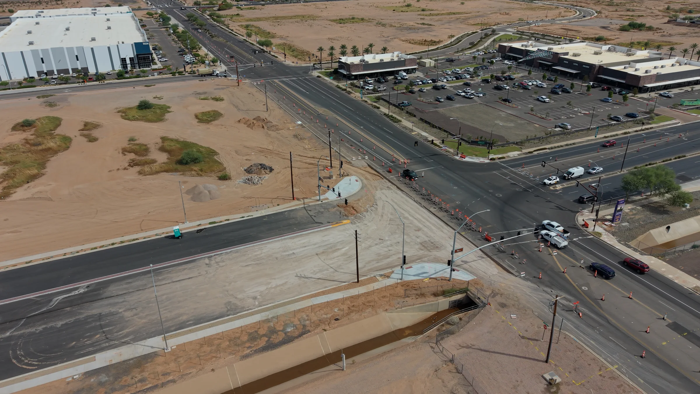
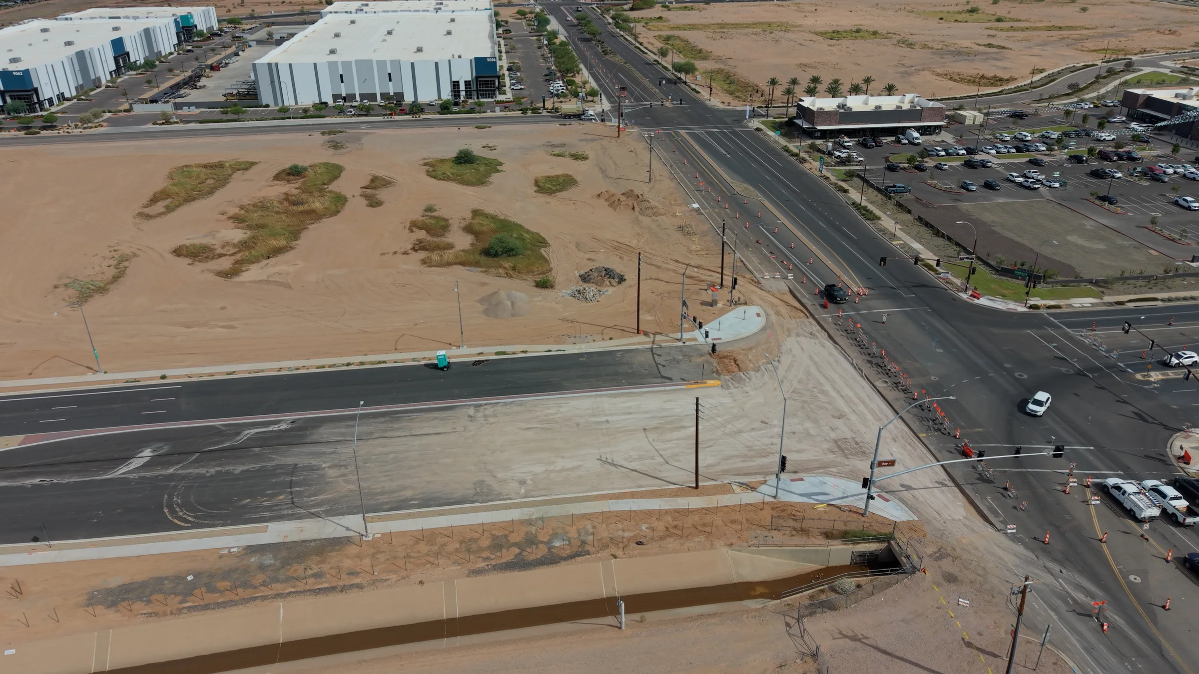
The September 21 aerial views document an unfinished approach to the intersection. Dark pavement and a divided roadway lead toward a broad, light-colored construction surface. Cones and barricades separate the work area from traffic moving through Ellsworth.
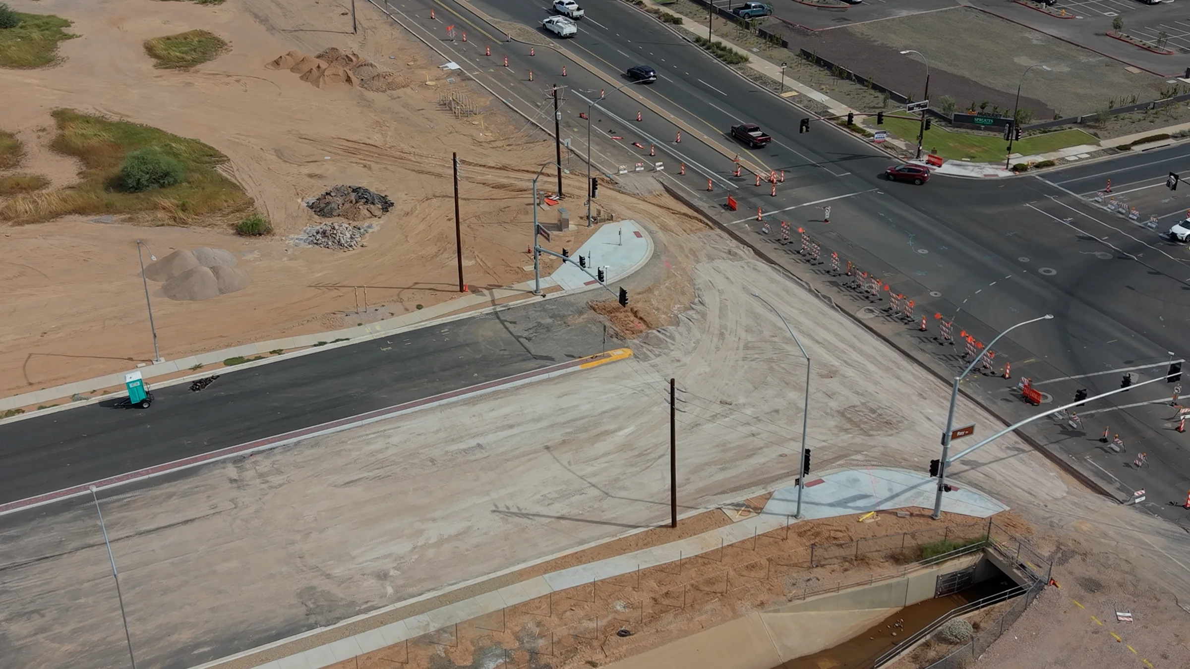
Concrete corner ramps and signal mast arms are visible in the new photos, along with utility poles beside the roadway. Those features document work in place; they do not establish that the new signals are commissioned, the utility conversion is complete or the connection is open.
The City of Mesa still lists fall 2026 as the estimated completion window. As checked October 22, its project page does not give a firm opening date, and the future Serenity/Skyline intersection closure remains undated.
The project at a glance
Where: Ray Road between Ellsworth Road and Hawes Road in southeast Mesa
What is being built: Three travel lanes in each direction, raised medians, new pavement, curb and gutter, sidewalks, storm drainage, streetlights, retention basins and signal upgrades at Ellsworth and Skyline
Current city schedule: Construction began in August 2025 and is estimated to finish in fall 2026
Contractor: Sunland Asphalt & Construction, LLC
Approved construction amount: $10.7 million, plus a 10% change-order allowance, for a total authorization of about $11.77 million
Funding: 2020 Street Bonds
The project is more than a widening. It creates a continuous, full-size arterial where the Ray Road alignment reaches Ellsworth, then continues east toward Hawes. The city says the work will also improve access to industrial properties along Serenity Avenue through a new connector road and traffic signal at Ray.
September 21 archive: what the photos show
The wide view shows the gap between the paved corridor and the active Ellsworth intersection. A drainage channel runs alongside the work area, while traffic cones continue through the surrounding lanes. The light-colored approach has not yet become a continuous, finished asphalt connection in these images.
The closer view highlights concrete corner ramps, signal equipment and the remaining roadway surface work. Mast arms are visible at Ray and Ellsworth even though Mesa’s online checklist still includes mast-arm installation. The photos cannot confirm whether every signal component is installed, tested or operating.
There is also a new reason for local drivers to pass through the area: Sprouts opened at Ellsworth and Ray on September 18. The shopping center and its parking lot appear in the new lead photo, placing the construction beside an active destination for neighborhood grocery trips.
Earlier views: the corridor in August
Our August coverage showed the wider roadway extending toward Loop 202. These earlier images provide context for the September intersection views; they are not photographs of today’s conditions.


What Mesa’s utility update still says
Mesa’s published project narrative continues to identify electrical and utility work as a dependency for the remaining intersection improvements. The page does not give a new date for that work.
In its project update checked October 22, the City of Mesa says Salt River Project has completed “shoofly” work—temporary poles and relocated overhead lines that create room for contractors to drill foundations and install conduit, traffic-signal cabinets and streetlights. The city’s posted narrative says SRP still needs to bore or excavate its own conduit, move the remaining overhead power lines underground and remove both the existing and temporary poles.
The city describes that utility work as enabling Sunland to complete paving, concrete ramps and sidewalks, and traffic-signal mast arms at Ellsworth. The September photos already show some of those physical elements in place, so the online narrative should not be read as a precise inventory of everything installed at the intersection today.
Visible construction progress and an official opening are different milestones. We have not found a new city announcement confirming completion of the underground conversion, signal commissioning or an opening date for the connection.
What is still on the city’s checklist
As checked October 22, Mesa’s online checklist still includes the following items. It has not been revised to distinguish the signal equipment visible in the new photos from any installation or testing that remains:
Reconstructing the intersection of Serenity and Skyline after the new Ray Road alignment is connected at Ellsworth
Installing traffic-signal mast arms at Ray and Skyline and at Ray and Ellsworth
Removing and replacing asphalt behind Nellis Auction’s easternmost driveway
Completing final adjustments, striping, signage and landscaping
Addressing final punch-list items
The city also says a future closure of the Serenity and Skyline intersection will be needed to reconstruct that roadway. The date remains to be determined, so drivers should watch posted signs and official project updates rather than relying on an old closure schedule.
Ray Road and Ellsworth Road are two connected—but separate—projects
Part of the confusion around this work is that two major City of Mesa projects meet in the same area.
The Ray Road Connection to Ellsworth runs from Ellsworth to Hawes and is being built by Sunland. The city’s target is fall 2026.
The adjacent Ellsworth Road Improvements project is broader. It runs from Loop 202 south to Germann Road and is being built by Sundt Construction. That project widens Ellsworth to six travel lanes, adds dedicated bike lanes, upgrades signals, installs new signage and pavement markings, improves storm drains and modifies medians, landscaping and irrigation. Its posted schedule runs from December 2025 through February 2027.
Mesa is phasing the Ellsworth work to reduce disruption: northbound widening first, moving north from Germann in roughly one-mile segments; southbound widening next, moving south from State Route 24; and median and landscaping work last.
For drivers, the distinction matters. Ray Road may reach its own finish line in fall 2026 while work elsewhere on Ellsworth continues into 2027. A cone or lane restriction near the intersection may belong to either project, even though the work appears to be one continuous construction zone.
Why this one-mile connection matters
On a map, the Ray Road project is only about a mile. In daily life, it closes a much more important gap.
Southeast Mesa has added neighborhoods, retail centers, industrial buildings and jobs at a pace that has changed how local streets are used. Ray Road sits near Eastmark, Cadence at Gateway, Phoenix-Mesa Gateway Airport and Loop 202. Completing the arterial gives drivers another continuous east-west route and gives businesses along Serenity a signalized connection to the larger street network.
The design also reflects demands beyond moving cars. Sidewalks make the corridor continuous for pedestrians. Street lighting and rebuilt signals improve visibility and organization at major crossings. Storm drains and retention basins manage runoff across low desert terrain where even brief storms can send a large volume of water toward the roadway. Raised medians control turning movements and create a more predictable arterial.
Dedicated bike lanes are part of the separate Ellsworth widening, helping tie the north-south corridor into the same upgraded network.
What drivers should expect next
Mesa’s posted completion estimate remains fall 2026, with no firm opening day listed as of October 22. Its utility narrative still describes underground conversion and pole removal as prerequisites for the remaining intersection work. The photographs alone cannot establish how much of that utility sequence is complete.
In the meantime, drivers should expect traffic control to change as work shifts between electrical systems, concrete, paving, signals and final striping. The city is asking motorists to slow down and follow posted signs throughout the work zone.
The photographs provide a record of how the connection looked in September. For current access, follow the traffic controls on site; neither older images nor an unchanged online checklist establishes which lanes or signals are operating today.
East Valley Explorer will continue following the Ray Road and Ellsworth Road projects as utility work, closures and opening milestones are announced.
